Two Cities, One River
Urban Corridor
WREC is working to enhance our downtown riverfront to increase greenspace, protect floodplains, and create a downtown that embraces and features the Wabash River.
Envisioning the Future
Corridor Master Plan Development
”Two Cities, One River: Master Plan for the Wabash River Urban Corridor” was developed at a high design detail level because its concentrated project area had implementation resources in place including a substantial amount of publicly owned corridor land. The urban corridor master planning process began with an inventory and analysis of existing resources. This provided an understanding of the natural and built conditions present within the corridor. Community surveys and small group and stakeholder meetings followed. These surveys and meetings allowed the Wabash River Enhancement Corporation (WREC) and its consultant to understand the community’s perspective and perceptions of the corridor. This included input regarding existing conditions, challenges, and opportunities. Three public meetings were held during the process. These informed the community about the progress of the planning efforts, presented new information and concepts, and sought community input on the plan’s direction and concepts.
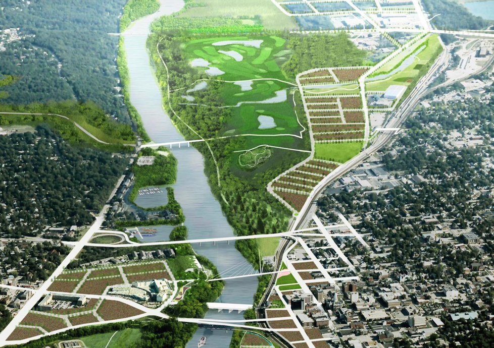
Two Cities, One River is not just an expression of the community’s desire to connect to the river, but a vision of a future in which the Wabash River is transformed into a beautiful, accessible centerpiece of a healthy, interconnected community. Documenting this vision in the master plan provides a road map to enhance the urban corridor over the next 20 years as resources and opportunities arise. It sets forth comprehensive enhancements for the Wabash River corridor as well as short-term priority projects. While the residents of the region and WREC are sensitive to current financial challenges, river enhancement is viewed as an essential investment that will encourage development and make the region more economically competitive. Building on the river’s beauty, the master plan seeks to restore a healthy river ecosystem and provide recreational and aesthetic amenities aimed at improving the health and well-being of the Greater Lafayette community.
Plan Goals: During the early stages of the master planning process, the community identified five widely supported goals that guided development of the master plan. Each plan recommendation was developed to support these goals while expressing a desire for an environmentally and economically responsible approach to effecting change along the Wabash River.
Corridor Goals:
Access from the cities to the river and create a healthy balance.
Cultivate healthy ecosystems.
Engage the whole community.
Connect the cities to each other.
Elevate the area to a sustainable place of choice.


Planning for Action
Meeting Our Goals
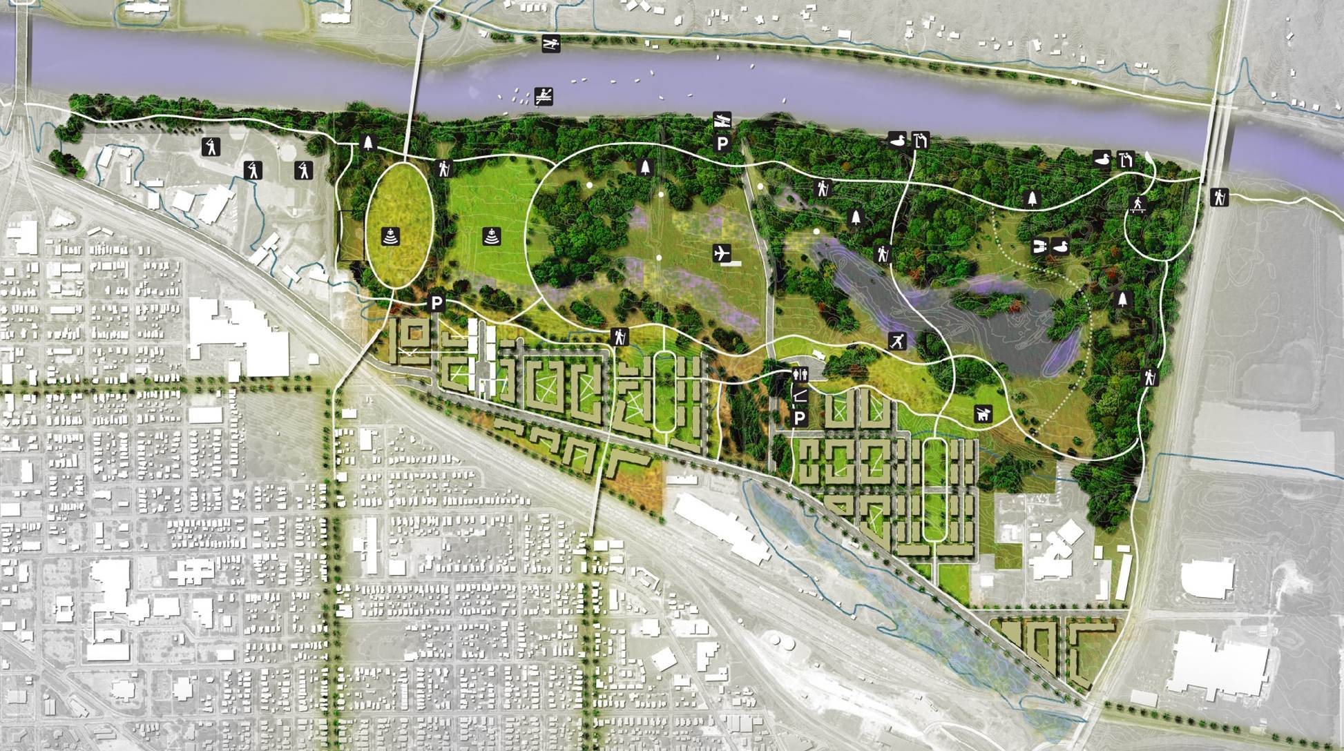
This level of community enhancement and quality of life improvement takes several stages of planning, design, and implementation. WREC has been leading the way in working to create a vibrant riverfront for Lafayette and West Lafayette. The urban corridor is divided up in to three areas: the North Reach, the Central Reach, and the South Reach. The North Reach extends from Sagamore Parkway on the east side of the River to Harrison Bridge and includes greenspace, wetlands, multi-use trails, and mixed development. The Central Reach extends from the Harrison Bridge to the South Street Bridge on both sides of the River and includes park space, forested floodplains, a new pedestrian bridge, and a band shell. Schematic design and engineering have been completed for two of these reaches and the reports can be seen below. Design and engineering for the South Reach has not yet been completed.